Today I’ll expand on a site that everyone needs to get familiar with for booking award travel. Great Circle Mapper (www.gcmap.com) is a site so embedded in award travel searches that I can’t think of a blog that doesn’t use. Today I’ll go over how to use GCmap to find flight distances between routes, and discuss how that will help you to book award flights.
Why Use the Site?
One great reason to use the site is to calculate total miles flown for programs that are distance based (Qantas & Avios programs as an example). The other is to see the route that your flights will take. Because the earth is not flat planes fly what are called “great circle routes,” which is where Great Circle Mapper gets its name.
The curvature of the earth lends itself to some very interesting maps. In our mind we’re thinking of the world as a flat map, so when we look at a route like this:
It appears that we’re flying an odd ‘sine-wave’ pattern, but we’re not (more on this later). If you had a globe you’d see that this is pretty much a straight line. The curl is due to the deformation of a flat map to approximate a curved surface.
Why is visually looking at a route like this helpful? Well if you want to go from SEA to MEL you can almost instantly see that Hawaii is really not too far off from the route. In fact, SEA-HNL-MEL is just an additional 5 miles over SEA-MEL. This might help you decide to break your trip there, or look at connections there to see if you can make award travel work.
The Original, and Simply the Best
One thing I love about the design of the site is that there is no bloat whatsoever. GCMap.com loads fast, generates maps quickly, and has lots and lots (and lots) of tweaks. The site is extremely easy to use, all you need are pairs of 3 character airport codes. For the most basic searches, simply put the three digit codes with a dash on the main search box:

Note: GCMap does not verify routes, it simply draws the GC route between those two points. You need to verify routes exist first with a site like www.flightconnections.com. The above flight does not exist, and neither does the SEA-MEL flight in the top picture!
Above you can see that the GC distance between LAS and SJD is 948 miles. Adding in an additional connecting airport is done by adding an additional IATA Airport code, followed by a dash:

As you can see above the segment distances are shown and the total route distances are shown. If you wanted to search multiple routes at once (maybe for open jaw travel) you would separate the routes with a comma:

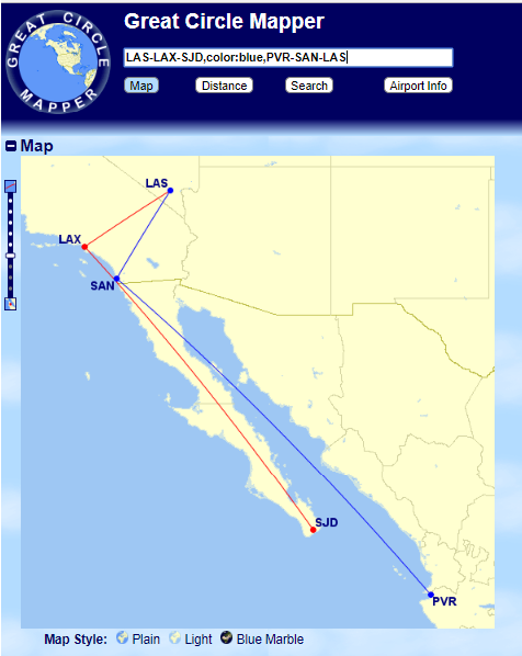
We’ve got a lot of information in the above image–and it becomes a little tough to see because the lines for each route are both red. GCMap allows you to change the color of lines using “,color:_______,” before a segment:
More Advanced Features
The above mapping, and distance calculation alone would make GCMap a great, useful site. But beyond routes GCMap has some other neat features I like to use. The first of these is drawing distances, the second is changing the focal point of the map (for better visual orientation).
To draw distance you just need to type the distance (in mi or km), then an @sign and then a 3 digit airport code:
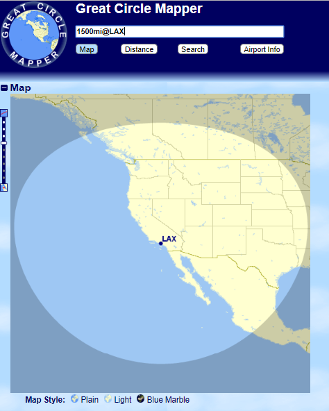
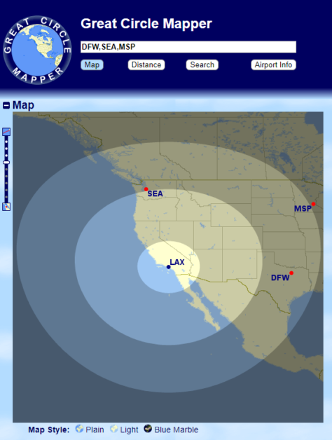
You can nest multiple distances as well by just typing more distances into the search bar. You can either separate each with a comma, or build upon a previous search by making a second search query at a new distance. GCMap holds the previous distance requests in memory and layers the new ones on top:
You can add cities to these maps to see if they fall into those circles by typing the 3 digit code for an airport or multiple aiports separated by commas:
Map orientation is another important feature of GCMap. Sometimes when searching for routes, especially polar ones the map looks very wonky:
Now there’s nothing wrong with viewing this route like this–it is the correct great circle route between Boston and Singapore. But visually it is tough to see, especially because SIN is almost off the edge of this orientation. We can use the “Map Conf” tab below the map to change the map to a flat/rectangular version to better fit our limited human brains:
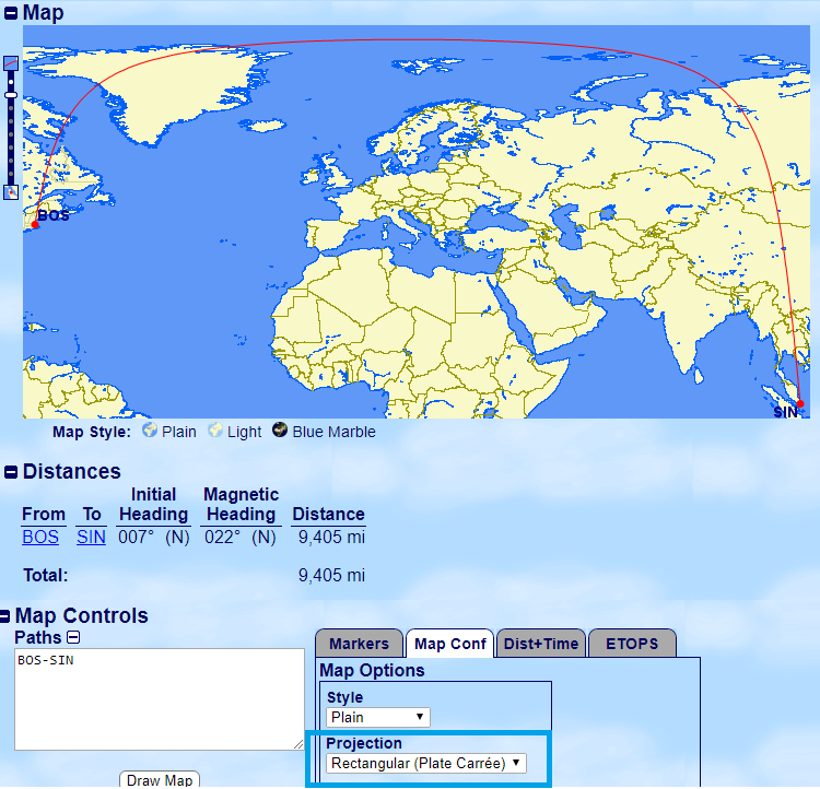
This route is identical to the globe shaped one above–but with the distortion of flattening a sphere visible. It looks like you’re taking extreme turns as part of this flight, but you’re not.
Only Scratching the Surface
I’ve only scratched the surface here of what GCMap.com can do. I did want to give a general overview of the site, especially since a lot of you might be finding yourself needing to calculate the distance between city pairs in the next 4 days or so. ?
If you’ve got a great GCMap tip, or a question about the site share it in the comments.



Oh and one of the greatest use of gcmap that you forgot to mention – planning an RTW trip, there is no way to plan a trip while not backtracking and flying in one general direction without gcmap.
milesmaximise: That’s so true. Thank you for sharing this. I hope as readers use GCMap more and more they’ll come back here and share more tips/tricks like yours.
It would be nice if there was an option to make the map window larger
It also would be nice to have the options of a coordinate grid overlay.